Access map to airport areas • 2017
Mode(s)


Service(s)
# Study
#Feasibility study
#Communication
#Web
Field(s)
#Modal choice
#Wayfinding >
#Strategy
#Access map
#Infomobilities
Country(ies)

Language(s)
#Français
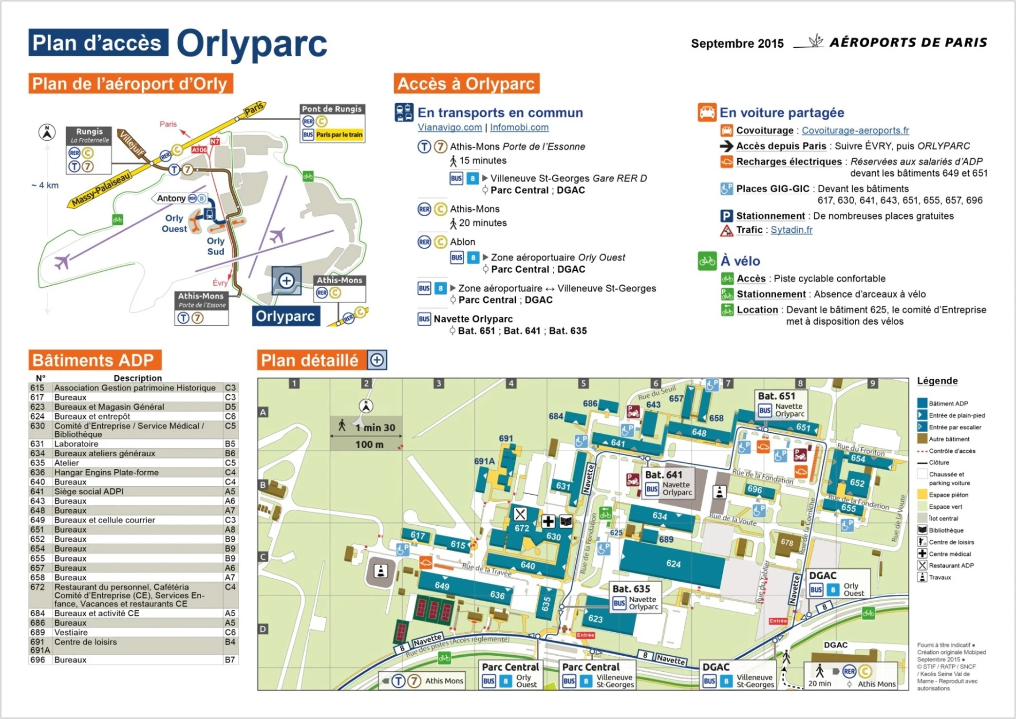
Description
Production of 10 multimodal access maps to Paris Airports buildings in the Paris Charles-de-Gaulle, Orly and Le Bourget airport zones.Beneficiary(s)
Paris' airportsStakeholder(s)
RATP (Paris transport operator) • SNCF (French railway company) • Keolis CIF • Transdev • Albratrans • Keolis Val De Marne • Ile de France MobilityCustomer testimonial

In 2015, Mobiped designed 10 access maps for the Paris' airport Group to cover all the airport zones of Paris-Orly, Paris-Charles de Gaulle and Paris-Le Bourget. The objective, achieved, was to promote in-house services buildings, walking and cycling spaces, public transport services and car-sharing solutions. These plans allow the employees and partners of the ADP Group to orient themselves/move easily in the various airport zones.

Visual(s)